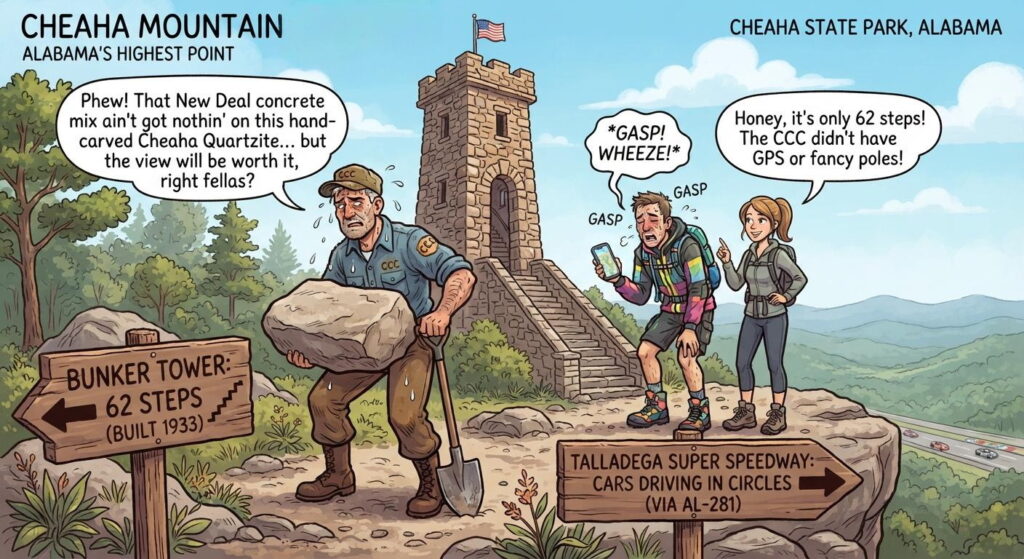
Cheaha Mountain is the highest natural point in Alabama, rising 2,407 feet above sea level. [1]
Humorous Overview
Here are a few jokes tailored directly to our conversation about Cheaha Mountain, Colonel Bunker, and the CCC:
- The Ultimate Weight Limit: The CCC built Bunker Tower with walls four feet thick out of solid quartzite just to make sure it could withstand the weight of tourists trying to take the perfect selfie at the highest point in Alabama.
- The Lookout Dilemma: Colonel Bunker insisted on a 360-degree wildfire lookout at the highest peak in the state, which is ironic because if there’s a fire at the bottom of a 2,407-foot mountain, the rangers will be the very last ones to find out.
- The Stairway to… Somewhere: Climbing 62 steps up a stone spiral staircase just to look out over the Talladega Super Speedway proves that Alabamians will go to great heights just to see people drive in circles.
- The Ultimate “Island in the Sky”: They call Cheaha State Park an “island in the sky,” which makes sense because after hiking the Pinhoti Trail, your legs will feel like they’ve been floating out at sea for a week.
- The $28 Million Upgrade: Alabama spent $28 million on a brand-new mass-timber lodge in 2026, which is amazing, considering the CCC built the entire lake, dam, and cabins using nothing but shovels, local stone, and a strong sense of New Deal determination.
Key Overview
- Elevation & Prominence: It stands at an elevation of 2,407 feet with nearly 1,500 feet of topographic prominence. [1, 2]
- Name Origin: Its name comes from the Muscogee (Creek) word “chaha,” meaning “high place”. [1]
- Location: It is located inside Cheaha State Park, Alabama’s oldest continuously operating state park (opened in 1933), situated on the southern tip of the Appalachian Mountains. [1, 2, 3]
- Summit Features: The peak features the historic stone-and-steel Bunker Tower, a Civilian Conservation Corps (CCC) observation deck built during the New Deal, as well as accessible scenic overlooks like Bald Rock and Pulpit Rock.
Bunker Tower
Bunker Tower is a historic, 50-foot-tall stone observation tower that crowns the summit of Cheaha Mountain, marking the literal highest point in Alabama. Named after Colonel Page S. Bunker—a former state forester—the tower is celebrated for its distinctive rustic architectural style and rich history. [1, 2, 3, 4]
Key Facts About Bunker Tower
- The Builders: It was constructed between 1933 and 1935 by Company 468 of the Civilian Conservation Corps (CCC), a New Deal program employing young men during the Great Depression. [1, 2]
- The Construction: It is built entirely of native Cheaha Quartzite, a rock so incredibly hard it is comparable to granite. The walls are up to 4 feet thick at the base and taper upward into a pyramid silhouette designed for ultimate structural resilience. [1, 2]
- Dual Purpose: The National Park Service designed it to serve two purposes: a public observation deck for tourism, and a fire lookout tower where park rangers could lodge and watch the horizon for forest fires. [1, 2, 3]
- Inside the Tower: Visitors can climb a twisting flight of 62 steps to the top observation deck. The wings flanking the base of the tower originally held park administrative offices and a gift shop, but today they house a CCC history museum. [1, 2, 3]
- The View: On clear days, the 360-degree overlook from the cab allows views stretching all the way to the Birmingham area, the Talladega Super Speedway, and even into neighboring Georgia. [1]
The tower was officially added to the Alabama Register of Landmarks and Heritage on December 15, 1989.
Page S. Bunker
The tower is named in honor of Colonel Page S. Bunker, who served as Alabama’s first state forester and the director of the state’s forestry commission during the 1920s and 1930s.
Why Colonel Bunker Was Honored
- Architectural Vision: Colonel Bunker was a fierce advocate for the use of native stone and timber in public park structures. He championed the “National Park Service rustic” style, ensuring the tower was built out of local Cheaha Quartzite so it would look like a natural extension of the mountain.
- Fire Protection Pioneer: As state forester, his top priority was setting up a network of high-altitude lookouts to protect Alabama’s timber from devastating wildfires. Because the tower was designed to serve a dual purpose as a scenic overlook and a vital wildfire lookout station, naming it after the head of forestry was a natural fit.
- CCC Collaboration: He played a massive role in coordinating with the federal government to bring the Civilian Conservation Corps (CCC) to Alabama, providing the exact workforce needed to build Cheaha State Park and the tower itself.
The tower was formally named to recognize his foundational role in creating Alabama’s state park system and forestry management programs.
Notable Things About Cheaha Park
Encompassing 2,799 acres of the rugged Talladega Mountains, Cheaha State Park is Alabama’s oldest continuously operating state park. Opened to the public in 1933, it acts as an “island in the sky” surrounding Cheaha Mountain. [1, 2]
Beyond being the roof of the state, it features a unique blend of New Deal history, rugged wilderness, and diverse recreation options. [1, 2]
The Hand-Dug Lake & Stone Architecture
The park owes its foundational architecture to three companies of the Great Depression-era Civilian Conservation Corps (CCC). [1, 2]
- Cheaha Lake: CCC workers hand-dug the entire 6-acre lake at the foot of the mountain. They also constructed a massive 300-foot-long, 30-foot-tall stone dam to fill it. [1, 2]
- Historic Structures: The legacy of the CCC remains highly visible in the park’s rugged stone architecture, including the lakeside bathhouse, 11 hand-hewn stone cabins, two open-air pavilions, and the spacious Bald Rock Group Lodge. [1, 2]
Multi-Mile Ridge Overlooks
The high-altitude granite outcroppings provide views that stretch above the cloud line on clear days: [1]
- Bald Rock Trail: Features a fully wheelchair-accessible 0.3-mile-long elevated wooden boardwalk that guides visitors smoothly through the canopy to a dramatic northern vista. [1, 2]
- Pulpit Rock Trail: A shorter, slightly more rugged path that leads down to a sheer rock face highly popular for local rock climbing and rappelling. [1]
Gateway to the Backcountry
Cheaha is the primary hub for some of the deepest wilderness backpacking and hiking networks in the American South: [1, 2]
- Pinhoti Trail Connection: The park is home to the Cheaha Trailhead for the Pinhoti National Recreation Trail. This long-distance singletrack path spans more than 335 miles across Alabama and Georgia, ultimately connecting to the Appalachian Trail system.
- The Cheaha Wilderness: The state park seamlessly borders the federally protected Cheaha Wilderness inside the Talladega National Forest. It serves as a launch point for grueling multi-day backpacking loops such as the 30-mile Pin-Chin-Sky circuit. [1, 2, 3, 4, 5, 6, 7]
Two Distinct On-Site Museums
A single admission fee into the park grants access to two entirely separate cultural centers: [1]
- The CCC Museum: Housed inside the base of the historic summit Bunker Tower, tracking the personal tools, uniforms, and daily lives of the men who built the park.
- The Walt Farr Native American Museum: Features an extensive collection of local historical artifacts, with a heavy focus on the stories and customs of Chief Shinbone’s tribe, who were hidden by early area settlers to avoid the Trail of Tears. [1, 2, 3]
Historical Warplane Crash Sites
The dense, unforgiving ridges surrounding the mountain hold somber pieces of aviation history. On January 4, 1944, a World War II P-38 Lightning warplane crashed directly into Bald Rock during a transit flight. A heavy machine gun salvaged from the site is displayed in the park museum. Hikers navigating the nearby McDill Point Trail will also encounter the preserved, rusted wreckage of a 1972 Piper aircraft crash. [1, 2, 3]
A Next-Generation Mountaintop Lodge
In October 2026, Alabama completed a major $28 million modern Lodge at Cheaha State Park. Built with an eco-conscious mass-timber design using native Southern yellow pine, the new four-story facility features 32 bluff-side rooms with private balconies and a rooftop bistro offering sweeping 360-degree views of the valleys below. [1]
Notable Differences from Neighboring Highpoints
Compared to highpoints and parks in neighboring states (like Georgia’s Brasstown Bald, Tennessee’s Clingmans Dome, or Florida’s Britton Hill), Cheaha Mountain and its state park possess several highly distinct characteristics:
The Southernmost Appalachian Singletrack Terminus
While most southeastern mountain parks feature isolated loop trails, Cheaha serves as the primary gateway and southern anchor for the Pinhoti National Recreation Trail. This 335+ mile trail is the longest continuous singletrack path in the region, bridging the gap between the southern pine forests of Alabama and the rugged Blue Ridge mountains of Georgia, eventually tying into the Appalachian Trail system.
A Pre-WWII Warplane Crash Site on an Active Trail
Unlike many mountain parks that restrict access to sensitive historic wreckage, Cheaha explicitly routes hikers past the preserved 1972 Piper aircraft crash site on the McDill Point Trail. The park also uniquely highlights its military history by displaying artifacts, such as a heavy machine gun salvaged directly from a World War II P-38 Lightning crash on Bald Rock, inside its on-site museum.
Dual-Identity Cultural Preservation
Most state park heritage centers focus narrowly on environmental history or a single local era. Cheaha uniquely hosts two entirely distinct, specialized museums on its grounds: one completely dedicated to the Great Depression-era Civilian Conservation Corps (CCC) construction workers, and another (the Walt Farr Museum) dedicated to preserving the specific artifacts and oral histories of the local Native American tribes who successfully evaded the Trail of Tears.
Eco-Conscious Mass Timber Architecture
While neighboring state park lodges typically feature standard mid-century concrete construction or basic log-cabin aesthetics, Cheaha boasts a brand-new, multimillion-dollar Lodge engineered entirely from Southern yellow pine mass timber. This design blends cutting-edge structural sustainability with a dramatic bluff-side architectural footprint unique to the Deep South.
Extreme Topographic Prominence from Flat Surroundings
Unlike highpoints in North Carolina or Tennessee that are nestled deep within massive, rolling mountain chains, Cheaha rises as a dramatic “sky island” straight out of the relatively flat Gulf Coastal Plain and Piedmont transition zone. This creates an abrupt, sheer vertical relief of nearly 1,500 feet, offering unobstructed 360-degree horizon views that are far more expansive than peaks surrounded by equally tall sister mountains.
Southeastern State Highpoints Comparison
Here is how Cheaha Mountain stacks up side-by-side against Brasstown Bald in Georgia and Clingmans Dome (formally known as Kuwohi) in Tennessee: [1, 2]
| Attribute | Cheaha Mountain (AL) | Brasstown Bald (GA) | Clingmans Dome / Kuwohi (TN) |
|---|---|---|---|
| Max Elevation | 2,407 feet | 4,784 feet | 6,643 feet |
| Topographic Prominence | 1,447 feet | 2,108 feet | 4,503 feet |
| Summit Architecture | 1930s rustic quartzite stone tower (Bunker Tower) | 1960s concrete observation deck and visitor center | 1959 brutalist concrete tower with a spiral ramp |
| Long-Distance Trail Association | Southern terminus of the Pinhoti Trail | Intersects the Wagon Train Trail | Intersects the Appalachian Trail |
| Unique Highlight | WWII and 1970s historic plane crash sites along the trails | On-site theater and interactive animatronic exhibits | Located in a unique subalpine spruce-fir rainforest |
| Surrounding Range | Talladega Mountains (Southern Blue Ridge) | Blue Ridge Mountains | Great Smoky Mountains |
Access
Cheaha Mountain is easily accessible via a paved drive-up route through the Talladega National Forest. [1, 2]
- Drives and Highways: You can reach the summit by car using the Talladega Scenic Drive (Highway 281) or Cheaha Road from Mumford, coming off Interstates 20 (exits 191 or 199). [1, 2]
- The Summit & Bunker Tower: The highest point (2,407 feet) is marked at Bunker Tower, a stone Civilian Conservation Corps (CCC) structure featuring a 63-step observation deck. [1, 2]
- Historic CC Road: The original CCC-constructed vehicle road to the summit has been closed to cars for years, leaving the old CC Road open as an interesting walking path with ruins.