
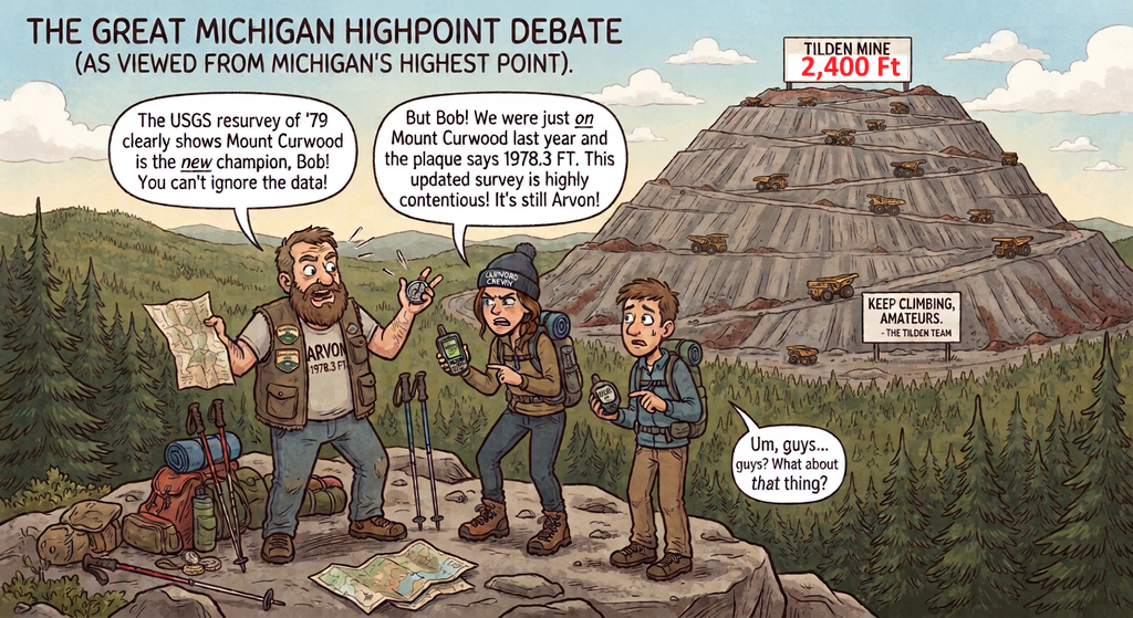
Michigan has that most interesting highpoint debate in the country. For years, Mount Curwood was considered the highpoint; then it was said that Mount Arvon (about 5 miles away) was the highpoint, and the Highpointers held their first-ever convention there in 1987. Last year, a Highpointer surveyed the highpoint and said Curwood was about 6 inches higher. The Higherpointer says the highpoint should be a natural highpoint. All the while, the Tilden Iron Mine has been building a piling mound about 48 miles away in the Upper Peninsula that has now reached 2,400 feet (its supposedly capped height).
Arvon/Curwood are in the Huron Mountain range while Tilden is located in the geological area known as the Marquette Iron Range.
Here are some jokes and a deep dive on Tilden.
Jokes
- Michigan highpointers will spend hours aggressively debating an extra twelve inches of natural dirt while completely ignoring a two-thousand-foot corporate monument to capitalism right next door.
- Nothing humbles a wilderness purist quite like checking their GPS on Mount Arvon only to realize they are being looked down upon by an active convoy of Caterpillar dump trucks.
- You haven’t truly experienced Michigan mountaineering until your breathtaking alpine view includes a three-story haul truck dumping fifty tons of iron ore tailings above the clouds.
- The craziest thing about the Mount Arvon vs. Mount Curwood debate is that a mining company settled the whole argument by accidentally building a bigger mountain out of their trash.
- It’s a special kind of Midwestern irony when you pack professional climbing gear for the state’s highest peak, only to find out the real summit requires an employee badge and a hard hat.
- Why argue over a few-foot difference between Arvon and Curwood when Cleveland-Cliffs can just dump another week of rock stripping and settle it forever?
Possible Name for Tilden’s “Mountain”
Pilings don’t normally have names but here’s some suggstions:
The Tilden Mine waste rock pile does not have an official geographic name, but within the Upper Peninsula community and among regional highpointers, it has earned a handful of funny, ironic nicknames:
- “Mount Cliffs” or “Mount Cleveland” (A play on the mine’s owner-operator, Cleveland-Cliffs Inc.).
- “The Trash Mountain” or “The Ore-Overburden Peak”.
- “Mount Tilden” (The most common shorthand designation for the artificial peak).
- “The Real Highpoint” (Used sarcastically by locals mocking the precise mathematical debates between fans of Mount Arvon and Mount Curwood). [1, 2, 3]
Ironic Mountaineering Names
- Mount Overburden: A literal nod to the geological term for the topsoil and rock stripped away to reach the iron ore.
- The Taconite Alps: A grand name for a mountain range made entirely of low-grade iron processing waste.
- The Cliffs-Top Peak: A play on the corporate owner, making it sound like a luxury mountain resort.
- Mount Repose: Named after the “angle of repose”—the steep engineering limit that keeps the loose rock from sliding down.
Local & Upper Peninsula Style Names
- The Ishpeming Sky-Pile: Shorthand that sounds like a local industrial landmark.
- The Yooper Everest: A humorous exaggeration of the U.P.’s ultimate elevation champion.
- The 50-Foot Terraces: Referencing the strict engineered lifts used to stack the mountain to its 2,400-foot heights.
- The Tilden Crater-Rim: Highlighting that the mountain only exists because a 2,000-foot deep hole is being dug right next to it.
Overview of the Tilden Mine
Tilden Mine is a massive open-pit iron ore operation located on the Marquette Iron Range near Ishpeming and Negaunee in Michigan’s Upper Peninsula. Operated by Cleveland-Cliffs Inc., it stands as the last remaining large, active iron mine in the Upper Peninsula. [1, 2, 3]
History
- Early Discoveries: Iron ore was first discovered in the Marquette Range in 1844, with formal mining beginning nearby at the Jackson Mine in 1847. [1]
- The Modern Pit: The current large-scale Tilden open-pit operation opened in 1974. It was backed by Cleveland-Cliffs and various North American steel companies to process low-grade ore. [1]
- The Shift in Technology: High-grade “direct-shipping” iron ore began running low across the range by the 1950s. This forced a massive technological shift toward mining low-grade hematite and magnetite. To make it usable, the rock has to be blasted, ground into a fine powder, separated from waste, and rolled into marble-sized pellets that reach 65% iron content. [1, 2, 3, 4]
- Sole Ownership: Cleveland-Cliffs became the sole owner of the Tilden Mine in 2017, right around the time its neighboring sister pit, the Empire Mine, closed down permanently. [1, 2]
Notable Features
- Massive Production Scale: Together with the former Empire mine, Tilden has historically produced up to 20% of North America’s iron ore. Tilden on its own has the capacity to churn out roughly 8 million tons of iron ore pellets annually. [1, 2, 3]
- The Logistical Chain: The processed pellets are loaded onto the Lake Superior & Ishpeming (LS&I) railroad, transported north to the ore docks in Marquette, and loaded onto Great Lakes ore freighters. These massive boats carry them down to steel mills on the southern shores of Lake Michigan. [1, 2, 3, 4]
- A Dual-Flavor Mill: One of Tilden’s most distinct engineering traits is its ability to process two entirely different kinds of ore. It primarily mines non-magnetic hematite, but midway through December, the mill shuts down to shift its entire operation—moving drills, massive shovels, and altering its circuits to use magnetic separators—to process magnetic magnetite for a few months. [1, 2]
- Gigantic Footprint: The mining footprint includes an enormous 1,400-acre water reservoir and a massive, tiered tailings basin that looks like a flattened industrial pyramid rising out of the UP wilderness. [1, 2]
- The Great Pipe-Cleaning Fire: Looking back into regional history, a previous underground iteration of a “Tilden Mine” (located further west in Bessemer, MI) suffered a devastating $50,000 fire in April 1913. The entire multi-day, 1,000-foot-deep shaft fire—which nearly suffocated 50 miners trapped on the tenth level—was caused entirely because a single miner carelessly tapped his pipe against a piece of wooden shaft lagging to clean it.
- Industrial Aromatherapy: Hikers, mountain bikers, and ATV riders exploring the multi-use trails and public lakes just north of the active Tilden pit often note the bizarre sensory contrast of the area. You can be sitting by a scenic Yooper lake while taking in “foul mineral odors” drifting directly off the active industrial mine operations.
- Non-Stop “Zombie” Operations: Because the heavy machinery, autogenous grinding mills, and flotation systems require immense capital investments, the mine runs 24 hours a day, 7 days a week, 365 days a year. When Cleveland-Cliffs needs to cut back on inventory, they don’t just slow down; they turn the entire operation off for weeks at a time, rendering one of the biggest industrial hubs in the state completely silent before waking it back up all at once.
Huron is a mountain range and the Marquette Iron Range is a geological belt rather than a chain of peaks
The primary difference is that the Huron Mountains are a true, natural mountain range, while the Marquette Iron Range is a geological belt of iron ore deposits rather than a chain of peaks.
Despite both containing geographic terms associated with elevation, they describe completely different features of Michigan’s Upper Peninsula.
The Huron Mountains: A Natural Range
- What they are: A rugged, compact range of ancient, heavily eroded mountains spanning parts of Baraga and Marquette counties.
- The Topography: They feature distinct, visible granite and slate peaks, steep ridges, cliffs, and deep valleys. This range includes Mount Arvon and Mount Curwood (historically debated as Michigan’s highest natural points).
- The Origin: They were formed by ancient tectonic forces and magma intrusions over two billion years ago, and later smoothed by massive glaciers during the last ice age.
The Marquette Iron Range: A Geological Ore Deposit
- What it is: A long, narrow economic-geological trend (about 40 miles long) containing massive deposits of low-grade iron ore.
- The Topography: It is a low, rolling rocky plateau rather than a jagged mountain chain. The word “range” here is a mining and geological term used to describe a strata or band of specific mineral rocks running across the landscape.
- The Human Impact: Because it is an iron range, human activity has dramatically altered its shape. The towering hills visible near the Tilden Mine today are not natural peaks of a mountain range; they are man-made waste-rock stockpiles built from the earth excavated to reach the iron ore below.
Quick Comparison
| Feature | Huron Mountain Range | Marquette Iron Range |
|---|---|---|
| Primary Definition | Natural chain of geologic peaks | Linear belt of rock containing iron ore |
| Meaning of “Range” | A row of mountains | A continuous trend or zone of mineral deposits |
| Highest Points | Natural summits (e.g., Mount Curwood) | Often man-made mine stockpiles (e.g., Tilden) |
| Primary Rock Type | Barren granite, gneiss, and metamorphic slate | Banded iron formations (hematite, magnetite, jaspilite) |