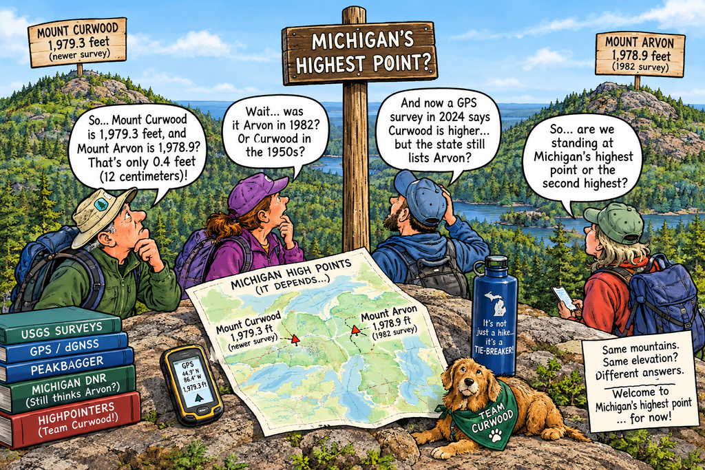
A private, peer-reviewed survey says the high point of Michigan is Mount Curwood rather than Mount Arvon. The debate over Michigan’s peaks has been going on for decades, with the very first Highpointers convention held to mark the change to Mount Arvon. Here’s some jokes about the debate and followed by a deep dive on the issue.
- Michigan’s highest point changed from Mount Arvon to Mount Curwood by about 12 centimeters. Even the mountains are arguing over who gets the last inch.
- Mount Curwood reclaimed the title after 42 years. That’s not a comeback—it’s a very slow-motion rematch.
- Mount Arvon was Michigan’s high point for decades. Mount Curwood finally passed it, then had the nerve to say, “I’ve been standing here the whole time.”
- Michigan’s mountain rivalry is so close, the winner was decided by technology—and probably a very patient surveyor.
- Mount Arvon lost the title by less than half a foot. Somewhere, a hiker is measuring their boot soles and asking for a recount.
- The state still hasn’t officially updated the high point. Bureaucracy moves so slowly, even the mountains have time to overtake each other.
- Michigan has two mountains fighting over the top spot, and both are still shorter than a really tall parking garage.
- Mount Curwood is back on top. Mount Arvon can take comfort in knowing it held the title longer than most people hold onto a gym membership.
- The difference is about 12 centimeters—roughly the height of a good snowbank, or one overly ambitious hiking boot.
- Michigan’s highest point is now Mount Curwood, pending final approval from the Department of “Let’s Check That Again.”
Deep Dive
(Background below is based on AI)
Mount Curwood (1,979.3 ft) and Mount Arvon (1,978.9 ft) have shifted back and forth as Michigan’s highest natural point due to periodic re-surveys and advancing measurement technology. [1, 2]
Timeline of the Highpoint Debate
- Pre-1950s: Government Peak in the Porcupine Mountains was long considered Michigan’s highest point. [1]
- 1950s–1982: A U.S. Geological Survey (USGS) re-survey determined that Mount Curwood (named after author James Oliver Curwood) was taller, making it the official state highpoint for roughly three decades. [1, 2]
- 1982: A USGS survey measured Mount Arvon at 1,979.24 feet—about 11 inches to 1 foot higher than Mount Curwood. Mount Arvon took the title and became the standard target for U.S. state highpointers for the next 42 years. [1, 2, 3, 4]
- October 2024: A differential Global Navigation Satellite System (dGNSS) survey by independent highpointers (Eric Gilbertson) measured Mount Curwood’s natural high point at 1,979.3 feet and Mount Arvon at 1,978.9 feet—putting Mount Curwood about 0.4 feet (12 centimeters) higher. These findings were published in the peer-reviewed journal Progress in Physical Geography: Earth and Environment. [1, 2]
- Current Status: While scientific and highpointer groups like Peakbagger have updated their data to recognize Mount Curwood, traditional bodies and state agencies (such as the Michigan Department of Natural Resources) have been slow to officially re-designate Mount Arvon.
The Global Navigation Satellite System (GNSS) is widely used to determine elevation because it provides continuous, three-dimensional (3D) coordinates (latitude, longitude, and height) anywhere on Earth using signals from at least four orbiting satellites. [1, 2]
Why GNSS is Preferred for Elevation
- 3D Positioning: Unlike traditional 2D methods or physical surveying tools that measure only horizontal distance, a GNSS receiver calculates latitude, longitude, and altitude simultaneously through trilateration. [1, 2]
- Speed and Convenience: Classical methods such as differential leveling (using physical benchmarks and rods) are labor-intensive, slow, and limited to local areas. GNSS allows field workers, phones, and aircraft to compute altitude in real time without requiring line of sight to local ground markers. [1, 2, 3]
- Global Coverage: Multiple constellations—including the US Global Positioning System (GPS), Europe’s Galileo, Russia’s GLONASS, and China’s BeiDou—operate worldwide in medium Earth orbit, ensuring signal availability almost anywhere. [1, 2]
- High-Precision Augmentation: While raw GNSS altitude measurements have limitations, technologies such as Real-Time Kinematic (RTK), ground reference stations, and satellite-based augmentation systems (SBAS) enable professionals to achieve centimeter-level vertical accuracy. [1, 2, 3, 4]
Important Caveats on GNSS Elevation
- Ellipsoidal vs. True Height: Raw GNSS measures height (\(h\)) relative to a smooth, mathematical model of the Earth called an ellipsoid (such as WGS84). Because the actual physical Earth is uneven and shaped by gravity, surveyors must subtract a geoid height (\(N\)) offset to convert it into a practical orthometric height (\(H = h – N\)) that matches mean sea level. [1, 2]
- Vertical vs. Horizontal Accuracy: Altitude readings from standard receivers are typically 1.5 to 3 times less accurate than horizontal positions because satellites are distributed above the horizon rather than beneath your feet. [1]
Updating a government-officially recognized peak or survey marker elevation on NOAA’s National Geodetic Survey (NGS) data sheets requires submitting high-accuracy field measurements through specific, rigorous channels. You cannot simply request a text edit; you must provide survey-grade data that meets federal standards.
AI Instructions on Accessing Mount Curwood
Mount Curwood is located in the Huron Mountains in L’Anse Township, Baraga County, Michigan. It stands at an elevation of 1,978 feet and is Michigan’s second-highest natural point. [1, 2, 3]
Trail & Access Details
- Trailhead Coordinates:
46.65398, -88.29293 - Summit Coordinates:
46.703004, -88.239504 - Hike Length: About 9.8 miles round trip from the standard trail, or roughly 9.5 miles round trip if approaching from intersections such as Silver Road when logging roads are impassable to vehicles.
- Elevation Gain: About 135 feet.
- Time: Around 3.5 hours of moving time (longer with weather or breaks).
- Difficulty: Rated moderate (flat grade with low vertical climb per mile).
- Best Time to Visit: Late May through October for snow-free conditions. [1, 2, 3]
Getting There & Navigation
- Approach: Reaching the area involves a network of unpaved, rough logging and off-road vehicle (ORV) roads branching out from near L’Anse and Skanee. [1, 2]
- Vehicle Recommendations: High-clearance or 4WD vehicles are strongly recommended, as road conditions frequently change due to logging activity. [1, 2, 3]
- Local Resources: You can check current road notes or pick up local maps at the Baraga County Tourist & Recreation Association in L’Anse (755 E. Broad St.) before heading out. GPS is recommended as it is easy to get turned around in the maze of timber roads. [1, 2]
Mount Curwood Name
Mount Curwood is named after James Oliver Curwood (1878–1927), a prolific American action-adventure author and conservationist from Owosso, Michigan. [1, 2] James Oliver Curwood wrote numerous outdoor and wilderness novels, many of which were adapted into film
AI Instructions on Accessing Mount Arvon
To access Mount Arvon—Michigan’s highest natural point at 1,979 feet—start from the town of L’Anse in the Upper Peninsula and follow the blue diamond-shaped trail/road signs (do not rely solely on general GPS apps). [1, 2, 3]
Driving Directions from L’Anse
- From L’Anse: Head north on Broad Street, turn right onto Main Street (becoming Skanee Road), and drive 16.1 miles to Roland Lake Road near Zion Lutheran Church; turn right. [1, 2]
- To Ravine River Road: Drive 2.9 miles on Roland Lake Road to Ravine River Road. [1]
- Follow the Blue Signs: Reset your odometer and follow the blue markers for roughly 7.2 miles through the forest, navigating various forks and turns (including passing a gravel pit at 1.8 miles and a steep incline at 6.4 miles) until you reach the final gravel parking lot. For a detailed mile-by-mile breakdown of every fork and turn, please refer to the referenced source. [1, 2, 3]
Reaching the Summit
- From the Parking Lot: Walk the remaining 0.3 to 0.5 miles along an easy path to the top.
- At the Top: Find the USGS benchmark, picnic table, and the signature blue mailbox containing the summit logbook. [1, 2, 3, 4]
Vehicle & Travel Tips
- Road Conditions & Vehicle: The final 14 miles consist of rough, unpaved logging roads. A high-clearance vehicle or SUV is strongly recommended, though careful passenger cars can manage in dry weather. [1, 2, 3, 4]
- Fees & Preparation: Access is completely free with no permits needed. Prepare in L’Anse for lack of facilities or cell service, and download offline maps beforehand. [1, 2]
Mount Arvon Name
The Welsh district of Caernarfon was used to name Mount Arvon because of the region’s historical slate industry. [1, 2]
In 1872, large deposits of slate were discovered in the Upper Peninsula of Michigan. Local inhabitants decided to name their newly established township after the famous Welsh slate-producing district of Caernarfon (historically spelled Carnarvon). The settlers shortened “Carnarvon” to Arvon to form the name of Arvon Township. [1, 2]
When the nearby mountain was officially designated the state highpoint just outside the township’s geographic boundary, it was named Mount Arvon. Though the local quarry operation in Michigan eventually failed, the connection to the Welsh mining district remains preserved in the landmark’s name. [1, 2]
Progress in Physical Geography: Earth and Environment
Progress in Physical Geography: Earth and Environment is a peer-reviewed academic journal established in 1977 and based in the United Kingdom. [1, 2]
Origins and Foundation
- Split from Predecessor: The journal was created out of the 1977 dissolution of the general publication Progress in Geography, which split into separate human and physical geography tracks (Progress in Human Geography and Progress in Physical Geography). [1]
- Editorial Leadership: Bruce Atkinson (Queen Mary College, London) served as the founding managing editor. [1]
- Core Purpose: It was founded to address the lack of representation of physical geography in the broader geographical literature and to provide a platform for research that combines physical-ecological and socio-environmental systems. [1]
Scope and Focus
- Interdisciplinary Reach: Publishes reviews, research, and methodological advances across physical geography, geosciences, climate change, biogeography, geomorphology, hydrology, and Earth system sciences. [1, 2, 3]
- Publisher: Published by SAGE Publications (bi-monthly format). [1]
- Impact and Indexing: Indexed broadly in databases such as SCOPUS and the Science/Social Sciences Citation Indexes, with an impact factor of 3.5.