
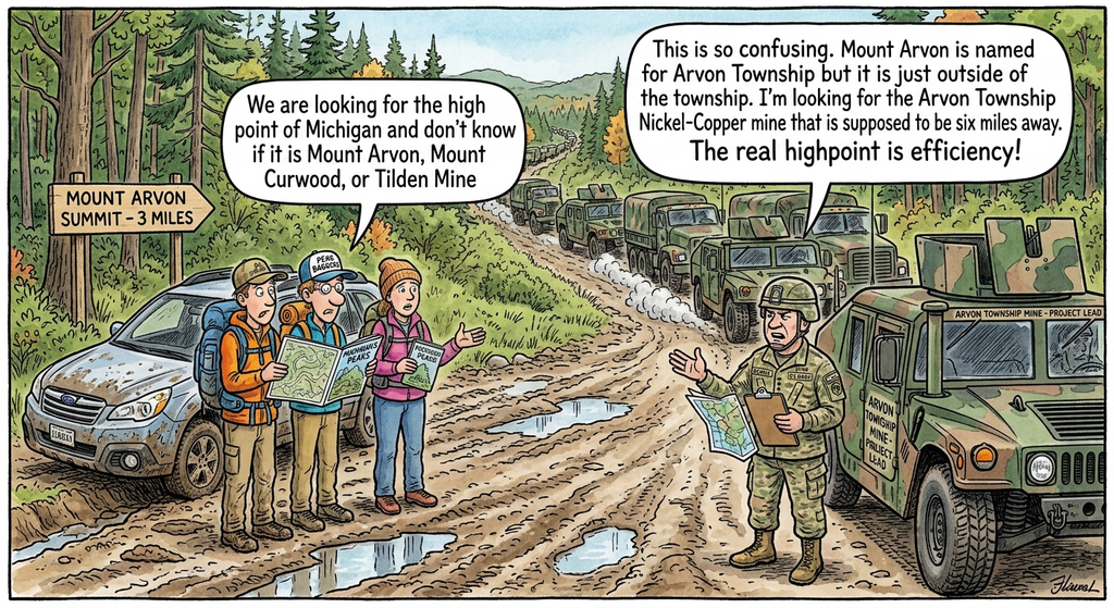
Mount Arvon is named for a neighboring township in Michigan (and the name derives from a Welsh mining area). This year, the U.S. Military is investing $5.22 million in a mine in Arvon Township, about 6 miles from Mount Arvon. We’ll tell some jokes about the situation and go on a deeper dive into the geology of the area.
Jokes
- The Pentagon is pouring millions into finding a mine in Arvon Township, which is perfect since the military also has decades of experience being lost in the woods.
- The highpointers are confused about the summit, the military is confused about the township lines, but everyone agrees the real obstacle is a Michigan pothole.
- Only the Department of Defense could look at a massive, billion-year-old mountain range and say, “Needs more paperwork.”
- The hikers can’t find the peak and the General can’t find the mine, making the Upper Peninsula backcountry the ultimate non-classified dead zone.
- Seeking efficiency in a county where the main highway is a gravel logging track is a tactical error no map can fix.
- The Pentagon wants to secure critical minerals in the Baraga Basin, but they’ll have to secure a high-clearance suspension for their Humvees first.
- It takes a special kind of military strategy to spend $5 million looking for a mine six miles away from a mountain named after a township it isn’t even in.
- You know you’re deep in the Upper Peninsula when a multi-ton military convoy gets out-maneuvered by a 2012 Subaru Outback.
- The General thinks the real highpoint is efficiency, which is a bold claim to make while standing knee-deep in a mud puddle.
- If the Department of Defense really wanted to find the absolute peak of confusion, they didn’t need a map—they just needed the Baraga County zoning board.
Deep Dive
Despite sharing the name, Mount Arvon actually sits just south of the township’s border, inside neighboring L’Anse Township. [1]
The Boundary Breakdown
- The Location: The peak of Mount Arvon lies entirely within the rugged, unorganized backcountry lines of L’Anse Township in Baraga County. [1, 2]
- The Name Paradox: The peak was named after Arvon Township because it was surveyed later and took its identity from the slate-mining boom happening just north of the border in Arvon territory. [1]
- The Mining Context Connection: Interestingly, this means the Department of Defense’s LM Project drilling area is located within Arvon Township near the Slate River, while Mount Arvon itself sits roughly 6 to 8 miles away in the next township over.
Arvon Name
The name Arvon is a direct linguistic export from the famous slate-mining region of North Wales. [1, 2]
When immigrants and industrial prospectors flooded into Michigan’s Upper Peninsula in the 1870s, they named the area after their homeland to honor its geological identity. [1, 2]
The Michigan Connection (1871–1872)
In 1871, a new civil township was established in Baraga County. A year later, in 1872, large, high-quality deposits of slate were discovered in the nearby hills. [1, 2]
Because the district of Carnarvon (modern Welsh spelling: Caernarfon) in North Wales was internationally famous as the epicenter of the global slate quarrying industry, the local inhabitants named their new mining village and township after it. To make it distinct, they shortened “Carnarvon” to Arvon. Later, when the nearby mountain peak was officially surveyed, it was named after the township. [1, 2, 3]
The Original Welsh Etymology
Long before it arrived in Michigan, the word had deep geographical roots in the Welsh language: [1, 2]
- The name stems from Arfon, a historic region in Gwynedd, Wales, located along the Menai Strait.
- In Welsh, it translates literally to “on the banks” or “by the river/sea”.
- It is a compound of “Ar” (meaning on or opposite) and “Afon” (the Welsh word for river). [1, 2]
Therefore, when you stand near the Slate River or atop Mount Arvon today, you are interacting with a name that means “by the river,” transplanted across the Atlantic by 19th-century Welsh quarrymen who recognized the exact same slate formations in the wild terrain of Lake Superior. [1, 2, 3]
Geology of the Area
they have entirely different geologies, meaning they do not share the same mineral profiles, and the resources being targeted at the mining site are completely absent at Mount Arvon.
While they are geographically close, they represent two radically different chapters in Earth’s history, separated by hundreds of millions of years.
+-----------------------------------------------------------------------+

|                       GEOLOGICAL CROSS-SECTION                        |
+-----------------------------------------------------------------------+

|  [ NORTH ]                                               [ SOUTH ]    |
|  BARAGA BASIN (Drilling Area)                      MOUNT ARVON (Peak) |
|                                                                       |
|  ~~~~~ Slate River ~~~~~                                 _/\_         |
|  =======================                                /    \        |
|  |  Michigamme Slate   |                               /      \       |
|  |  (Proterozoic Basin)|                              / Granite\      |
|  |                     |                             /  & Gneiss\     |
|  |   [==========]      |                            /  (Archean) \    |
|  |   I  Magma   I <--- | --------------------------/---------------\   |
|  |   I  Conduit I      |                          ( Ancient Basement) |
|  |   [==========]      |                                              |
|  +---------------------+----------------------------------------------+

|   Target: Nickel-Copper                            Target: None       |
|   Sulfide Deposits                              (Barren Basement Rock)|
+-----------------------------------------------------------------------+
The Drilling Site: A Proterozoic Magmatic Conduit
The LM Project exploratory area is located in the Baraga Basin. [1]
- The Rock: This area is dominated by younger Proterozoic sedimentary layers like the Michigamme Slate, which have been punched through by underground volcanic “plumbing” systems (magmatic conduits and dikes). [1, 2]
- The Mineralization: About 1.1 billion years ago, during the formation of the Midcontinent Rift system, superheated magma was injected into these underground plumbing systems. As the magma interacted with sulfur-rich country rock, it formed heavy nickel-copper sulfide minerals that settled into dense pools. This is the exact same geological phenomenon that formed the highly lucrative Eagle Mine nearby. [1]
Mount Arvon: An Ancient Archean Basement
Mount Arvon is a distinct geologic feature, part of the Archean Huron Mountain Complex.
- The Rock: The mountain is part of Earth’s ancient “basement” crust, composed primarily of ultra-hard granites, gneisses, and greenstone slates that are between 2.5 and 2.7 billion years old.
- The Mineralization: This granite mass formed extremely deep underground as a massive, slow-cooling body of magma that was completely devoid of concentrated metals. Over eons, tectonic pressure thrust this ancient block upward, and millions of years of glacial erosion shaved away the softer surrounding rock, leaving Mount Arvon behind as a high, barren ridge.
Why You Won’t Find Nickel or Copper on the Peak
Because Mount Arvon consists of ancient, barren granites rather than the younger, rift-related magmatic conduit zones found down in the basin, it completely lacks the nickel-copper sulfide chemistry. There are no valuable critical metals or fossil fuels on the mountain itself. The exploration teams must specifically target the deep sedimentary basin and fault lines 6 to 8 miles to the north to track down the metal-rich volcanic pathway
Project Details
The U.S. Department of Defense (Pentagon) is investing $5.22 million to fund exploratory critical mineral drilling in Arvon Township, Michigan. [1]
The initiative, known as the LM Project, targets a nickel-copper project located in the Baraga Basin near the Slate River. Rather than conducting mining operations itself, the Department of Defense is using defense industrial base funding to secure domestic supply chains for metals critical to national security and military hardware. [1, 2]
Key Details of the Initiative
- The Funding: The $5.22 million grant was awarded to Trans Superior Resources (TSR), a Michigan-based exploration company. TSR is a subsidiary of Bitterroot Resources, a mineral exploration firm headquartered in West Vancouver, Canada. [1]
- The Minerals: The project targets nickel-copper sulfide deposits. Nickel and copper are highly sought-after critical minerals essential to military applications, defense manufacturing, and advanced energy supply chains. [1, 2]
- The Site: The exploratory drilling area is in the Baraga Basin, within Arvon Township (Upper Peninsula of Michigan), near the Slate River. [1]
- Timeline: The funding follows prior private exploratory drilling conducted between 2020 and 2022, which intersected nickel-copper mineralization in 10 of 26 test holes to depths of 325 meters. With the federal funding secured, advanced exploratory drilling is projected to begin next year. [1]